 Trails in the Icefields Parkway Area
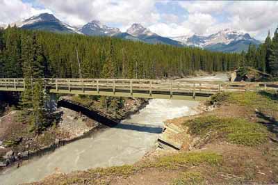
Bridge over the North Saskatchewan
July 2004: Survey Peak, 2667 m, on the left, two buttresses of Mount Erasmus, 3265 m, in the centre, and Mount Amery, 3329 m, on the right, stretch up the valley of the North Saskatchewan River, from where the Glacier Lake Trail bridge crosses the river.
Topo Map: Mistaya Lake 82 N/15
Trail: Glacier Lake
Ref: CRTG p. 136


All Content © David Wasserman. All rights reserved - Commercial use without express written permission of the copyright holder is expressly forbidden.