 Trails in the Icefields Parkway Area
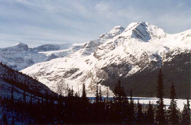
Mount Athabasca
October 2002: When the trail breaks out of the trees, the alluvial plain of the headwaters of the North Saskatchewan River comes into view. The east side of Mount Athabasca, 3491 m, rises across the valley. The northern aspect of Athabasca, from the Athabasca Glacier/Columbia Icefields side, is more familiar.
Topo Map: Columbia Icefield 83 C/3
Trail: Saskatchewan Glacier
Ref: CRTG p. 146


All Content © David Wasserman. All rights reserved - Commercial use without express written permission of the copyright holder is expressly forbidden.