 Trails in the Tonquin Valley Area
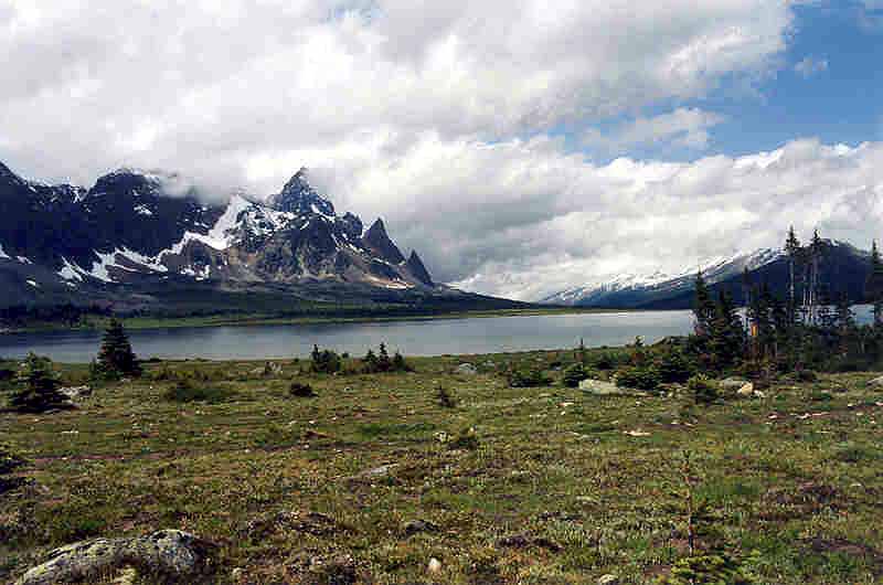
The Ramparts and North Amethyst Lake
July 2004: The Tonquin Valley is actually a high plateau that drains in two directions: north via Moat Creek and east by the Astoria River. From this vantage point near the Amethyst Campground the view is toward the west, where the low Moat and Tonqu
in Passes mark the Continental Divide and the Alberta-British Columbia border. The headwaters of the Fraser River are joined by Tonquin Creek on the BC side.
Topo Map: Amethyst Lakes 83 D/9, Jasper 83 D/16
Trail: Maccarib Pass
Ref: CRTG p. 196


All Content © David Wasserman. All rights reserved - Commercial use without express written permission of the copyright holder is expressly forbidden.