 Trails in the Peter Lougheed Park Area
 Trails in the Peter Lougheed Park Area
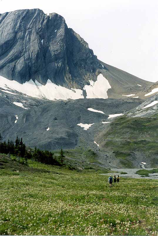
Warrior Mountain
August 2005: Between Aster Lake and the slopes leading up to Northover Ridge is a rocky alluvial flat collecting the run-off from the Mangin Glacier, part of the Northover Glacier, and numerous snowfields. When run-off is high, the flat is under water and the best route is around the north side of Aster Lake and the flat. On this occasion, the flat was dry. Warrior Mountain is 2973 m in elevation. There are only traces of trail leading up from the flat toward the ridge.
Topo Map: Kananaskis Lakes 82 J/11
Trail: Northover Ridge
Ref: KCTG p. 240
![]()
![]()
![]()
![]()
![]()
All Content © David Wasserman. All rights reserved - Commercial use without express written permission of the copyright holder is expressly forbidden.