 Trails in the Peter Lougheed Park Area
 Trails in the Peter Lougheed Park Area
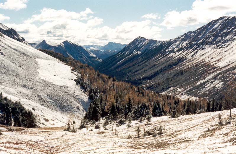
South from Highwood Pass
October 2001: Mount Arethusa on the left and Highwood Ridge on the right define the Storm Creek Valley south of Highwood Pass. The pass, at 2206 m, is the highest point reachable by public road in Canada.
Topo Map: Mount Rae 82 J/10
Trail: Ptarmigan Cirque
Ref: CRTG p. 392
![]()
![]()
![]()
![]()
![]()
All Content © David Wasserman. All rights reserved - Commercial use without express written permission of the copyright holder is expressly forbidden.