 Trails in North Kootenay National Park
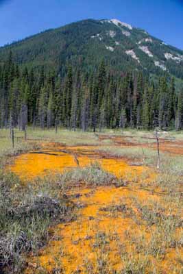
Orange Mud
August 2009: The high point north of the the ochre beds is the end of a long ridge whose nearest named summit is Mount Oke, more than 12 kilometres to the northwest.
Topo Map: Mount Goodsir 82 N/1
Trail: Paint Pots
Ref: CRTG p. 317


All Content © David Wasserman. All rights reserved - Commercial use without express written permission of the copyright holder is expressly forbidden.