 Trails in the Icefields Parkway Area
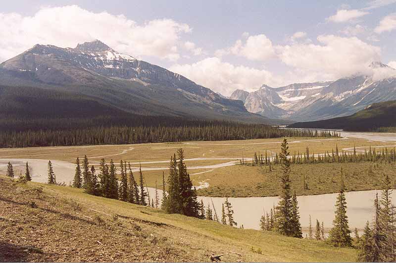
Howse River Valley
July 2004: Mount Sarbach, 3155 m, on the left is on one side of the Howse River, while Mount Outram, 3240 m, on the right is on the other side.
Topo Map: Mistaya Lake 82 N/15
Trail: Glacier Lake
Ref: CRTG p. 136


All Content © David Wasserman. All rights reserved - Commercial use without express written permission of the copyright holder is expressly forbidden.