 The Skyline Trail
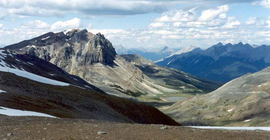
Mount Tekarra and the Colin Range
July 2003: Mount Tekarra, 2694 m, on the left, and the Colin Range in the distance across the Maligne Valley, are the views northward before the Skyline Trail descends into the valley, leaving the Amber Mountain Ridge.
Topo Map: Athabasca Falls 83 C/12, Medicine Lake 83 C/13
Trail: Skyline
Ref: CRTG p. 226


All Content © David Wasserman. All rights reserved - Commercial use without express written permission of the copyright holder is expressly forbidden.