 Trails in the North Kananaskis Area
 Trails in the North Kananaskis Area
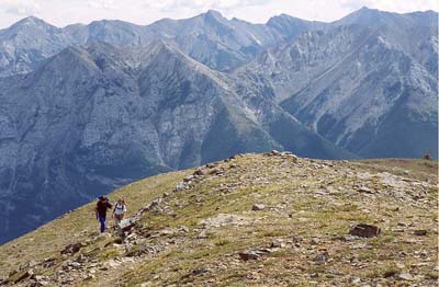
Fisher Range
August 2002: Looking back down the trail, hikers see the Fisher Range across the Kananaskis Valley. The trail has more than 1300 metres of elevation gain between the valley floor and Mount Allan summit.
Topo Map: Spray Lakes Reservoir 82 J/14
Trail: Mount Allan/Centennial Ridge
Ref: KCTG p. 116
![]()
![]()
![]()
![]()
![]()