 Trails in the Peter Lougheed Park Area
 Trails in the Peter Lougheed Park Area
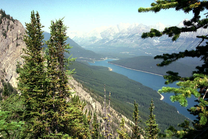
North End Lower Lake
August 2000: The Opal Range stretches northward on the other side of the north end of Lower Kananaskis Lake, seen here from the viewpoint at the end of the trail. Highway 40 can be seen going north toward the Trans-Canada Highway.
Topo Map: Kananaskis Lakes 82 J/11
Trail: Mount Indefatigable Lookout
Ref: KCTG p. 231
![]()
![]()
![]()
![]()
![]()
All Content © David Wasserman. All rights reserved - Commercial use without express written permission of the copyright holder is expressly forbidden.