 Trails in the Rockwall Area
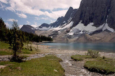
Floe Lake and the Southern Rockwall
August 1993: The western boundary of Kootenay National Park runs along the summit ridge of the Rockwall.
Topo Map: Mount Goodsir 82 N/1
Trail: Floe Lake
Ref: CRTG p. 330


All Content © David Wasserman. All rights reserved - Commercial use without express written permission of the copyright holder is expressly forbidden.